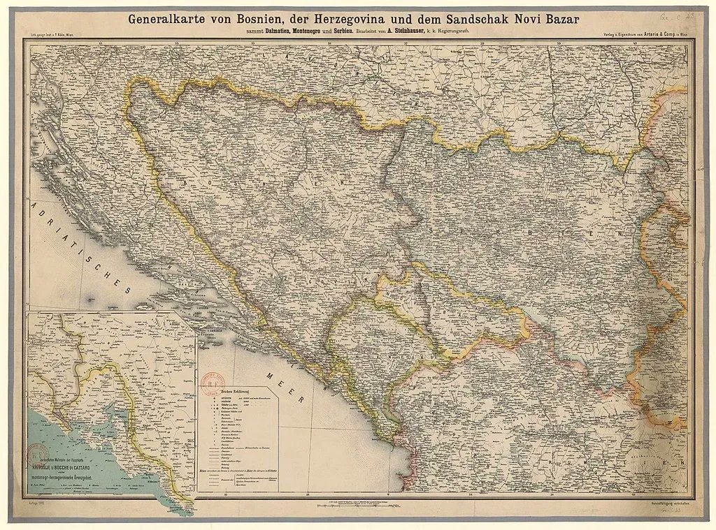
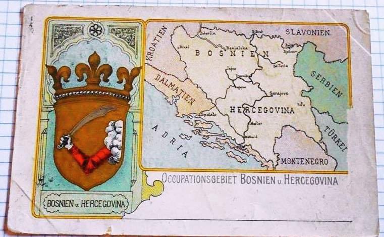
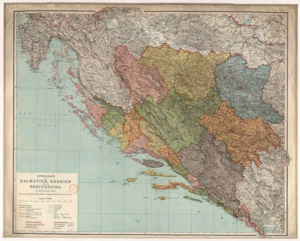
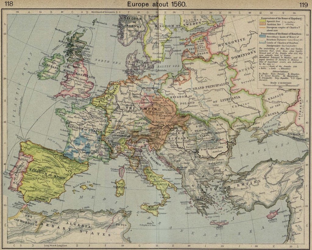
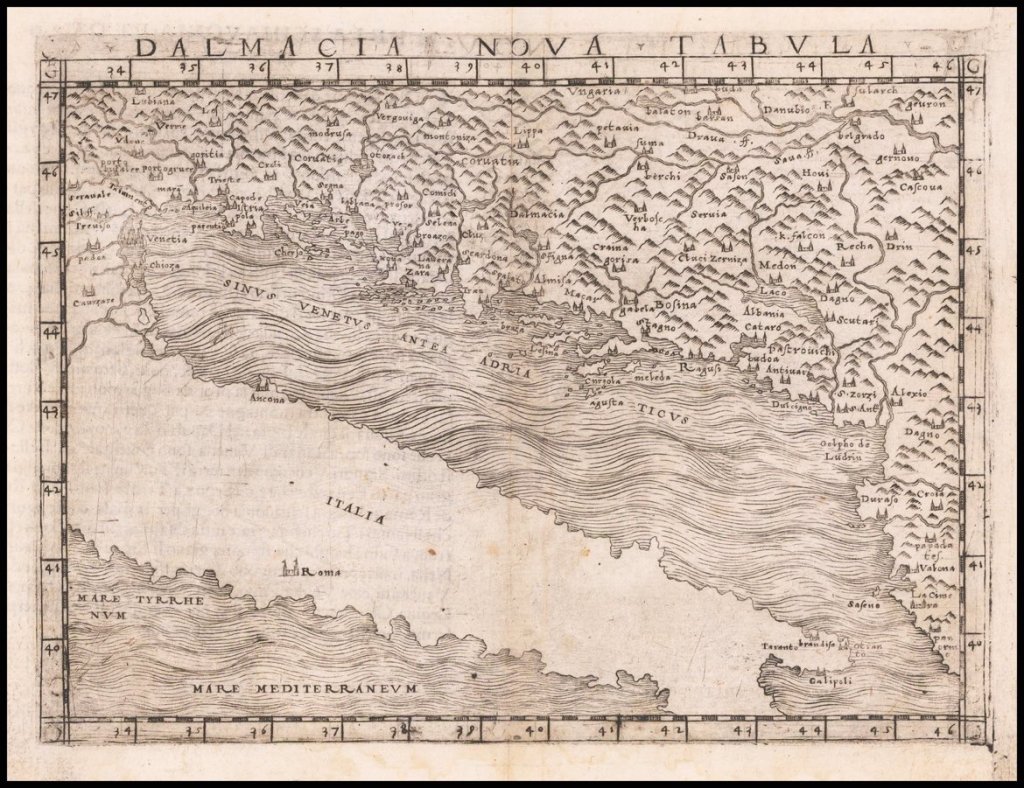
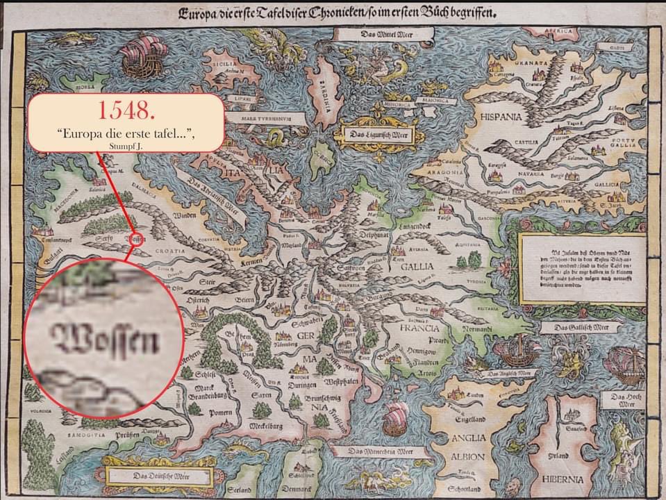
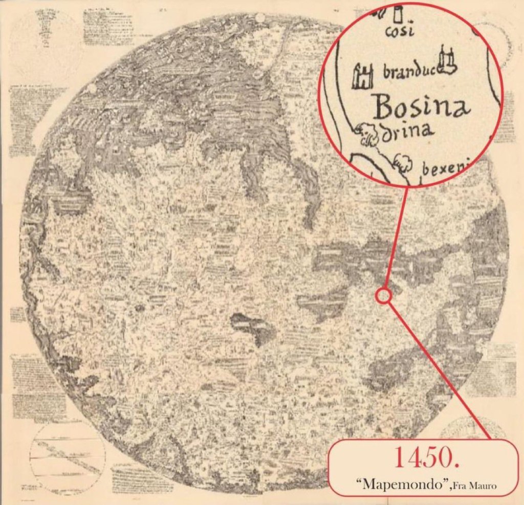
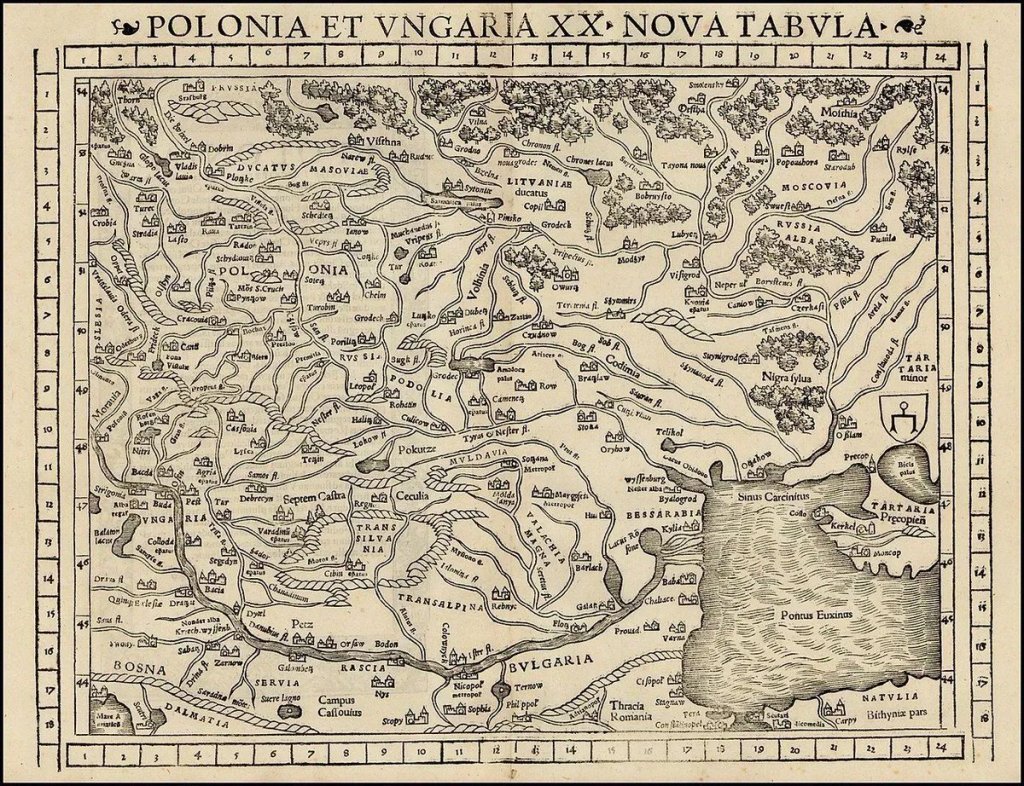
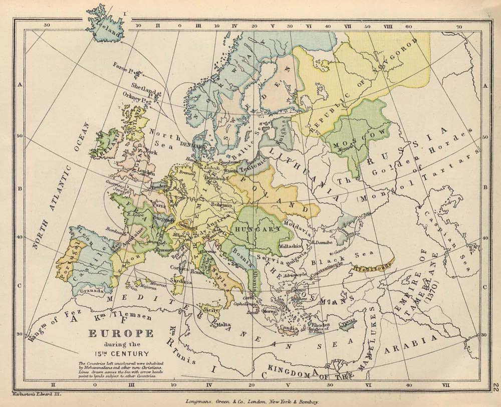
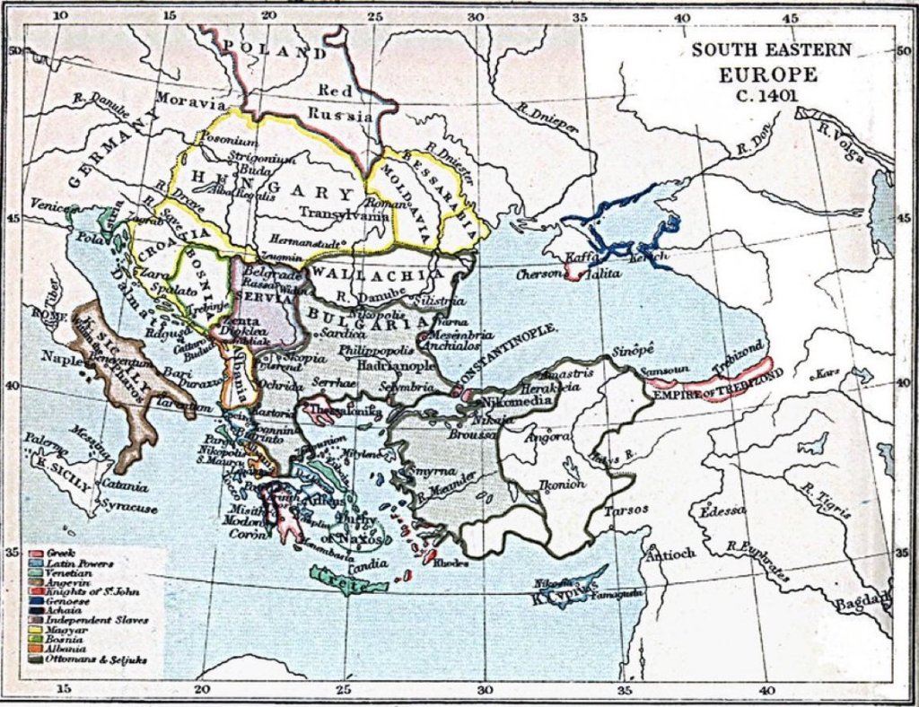
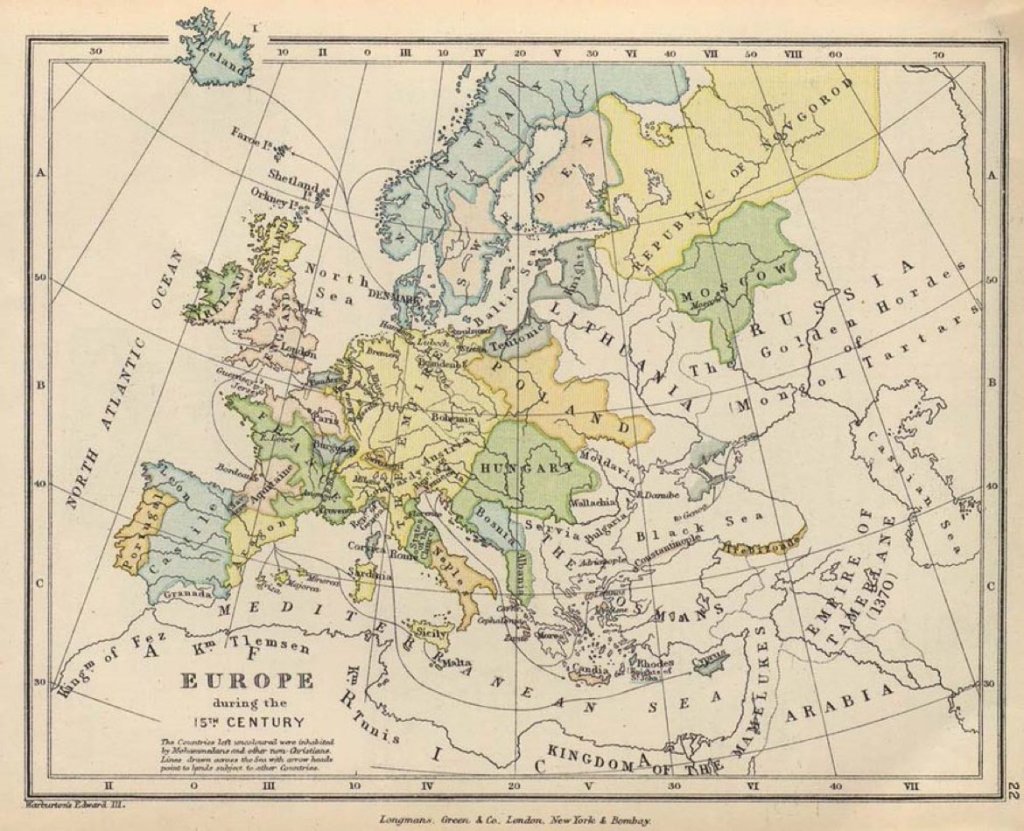
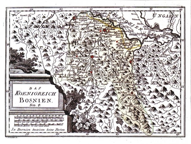
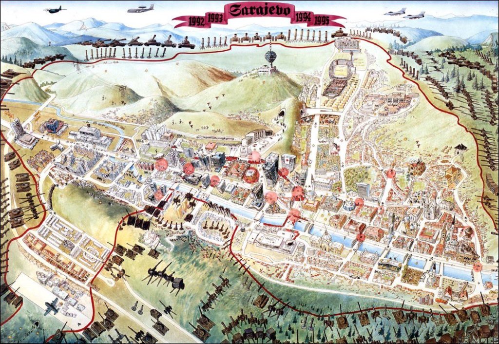
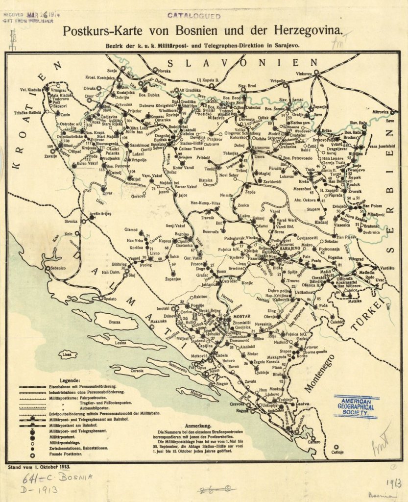
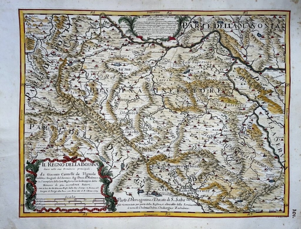
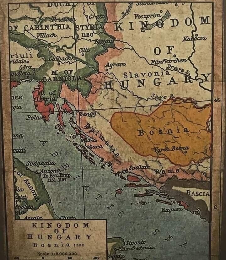
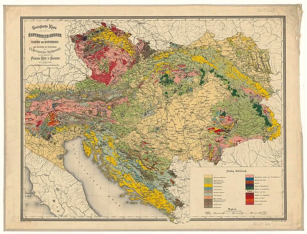
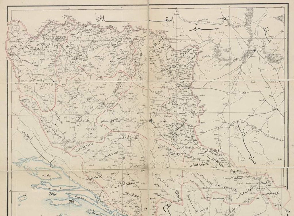
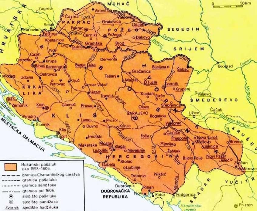
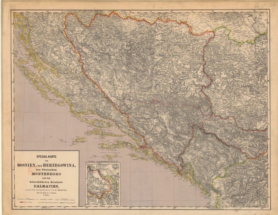
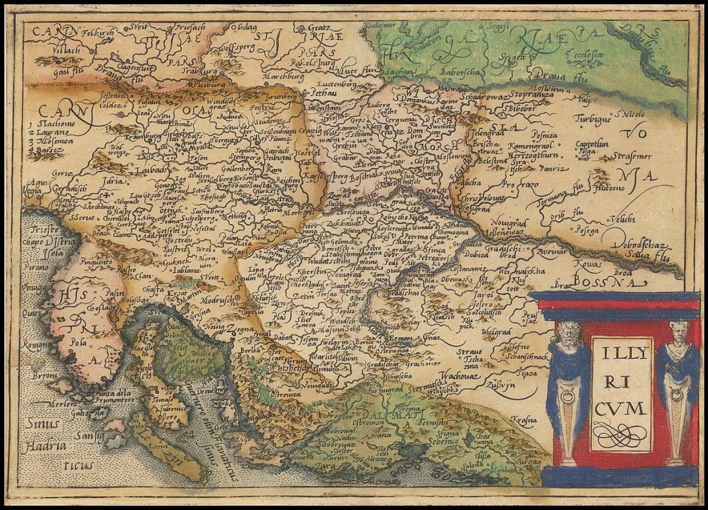
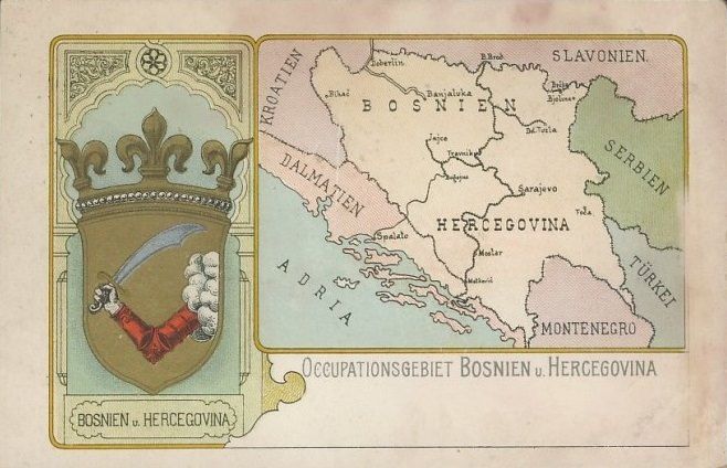
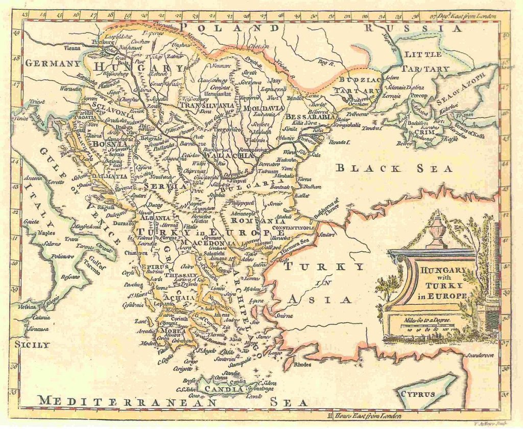
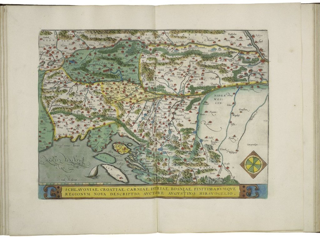
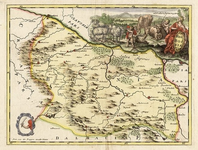
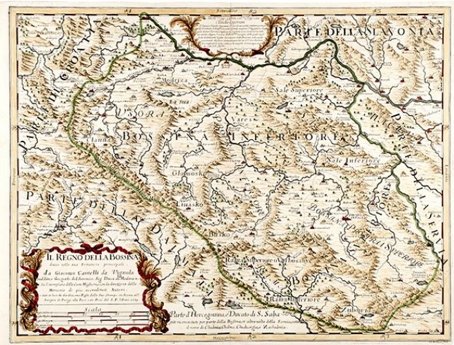
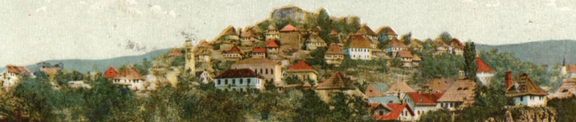
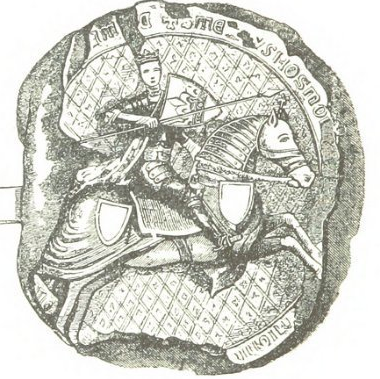
1882 map of Bosnia and Herzegovina and Sanjak Novi Pazar.Map and seal of #Bosnia postcard1914 map of Dalmatia and Bosnia and HerzegovinaMap of Europe; Year about 1560 From The Historical Atlas by William R. Shepherd, 1923. University of Texas Library.Antique map showing Bosnia and Herzegovina by Giacomo Gastaldi, 1548Stumpf (Johann), Untitled map of Europe, circa 1548. #BosonaThe Fra Mauro map is a map of the world made around 1450 by the Italian cartographer Fra Mauro – #Bosnia perennially present.Munster’s map of Poland, Lithuania, the Ukraine, Moscovy and the Balkans, extending from Prussia, Vilna and Smolensky in the north to Bosnia, Bulgaria, Constantinople and the Crimea in the south, centered on Poland – 1552.Map of Europe; 15th Century #Bosnia from The Public Schools Historical Atlas edited by C. Colbeck, published by Longmans, Green, and Co. 1905.Map of South Eastern Europe; Year 1401 – #Bosnia in green borders European Map Collection at University of Texas (Atlas To Freeman’s Historical Geography, 1903).Map of Europe; 15th Century – From The Public Schools Historical Atlas edited by C. Colbeck, published by Longmans, Green, and Co. 1905. – #Bosnia in blue shadingA map of the Kingdom of #Bosnia by Franz Johann Jeseph von Reilly, a Viennese cartographer – Copper engraving – 1789.Pictorial map of the siege of #Sarajevo. Shows the siege forces which encircled the city and surrounding hills with weapons that included artillery, mortars, tanks, heavy machine-guns, rocket launchers, aircraft bombs, etc.1913 postal map of #Bosnia and Herzegovina. (k.u.k. Militiirpost- und Telegraphen-Direktion)“Il Regno Della #Bossina” – old map of the Kingdom of #Bosnia by Giacomo Cantelli da Vignola and Gio Giacomo de Rossi, 1689.Map of Bosnia 1200 (still under the reign of Kulin Ban)1880s geological map of Austria-Hungary, #Bosnia and Herzegovina and MontenegroMap of Europe; 15th Century From The Public Schools Historical Atlas edited by C. Colbeck, published by Longmans, Green, and Co. 1905. – #Bosnia in blue shadingAn Ottoman map of Bosnia and Herzegovina – 1870A map of the Eyalet of Bosnia between 1593 and 1606A 1855 first edition example of Colton’s map of Turkey in Europe.1885 map of #Bosnia, Herzegovina, Montenegro, and Dalmatia.1579 map of the Northern Balkan region of Illyricum by Johannes Matalius MetellusMap and crest of #Bosnia and Herzegovina, 1880A map by T. Jefferys, 1785 The map shows Hungary and the bordering Balkan regions controlled by the Ottoman Empire.Map of Slavonia, Croatia, Carnia, Istria, and #Bosnia by Abraham Ortelius. Theatrum Orbis Terrarum. London, 1606 (i.e. 1608?). Plate 92.Kingdom of #Bosnia – Regnum Bosniae – 1737 – by Johann Van Der BruggenA map of the Kingdom of #Bosnia by Franz Johann Jeseph von Reilly, a Viennese cartographer – Copper engraving – 1789Il Regno della Bossina – the Kingdom of #Bosnia – Giacomo de Rossi – Rome – 1690